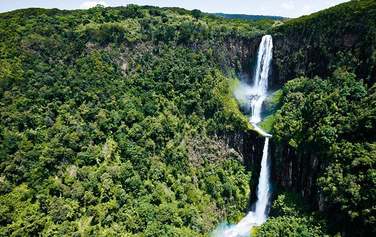
The site is located on the Central Highlands, west of Mount Kenya; Nyeri District; Central Province; covers 766km2 distance180 Kms drive from Nairobi. The Aberdares are an isolated volcanic range that forms the eastern wall of the rift valley, running roughly 100km north south between Nairobi and Thomsons Falls. Soils are red and of volcanic origin, but rich in organic matter. There are two main peaks, Ol Donyo Lesatima (3,999m) and Kinangop (3,906m) separated by a long saddle of alpine moorland at over 3,000m. The topography is diverse with deep ravines that cut through the forested eastern and western slopes and there are many clear streams and waterfalls. The Aberdares are an important water catchment area providing water to the Tana and Athi rivers and part of Central Rift and Northern drainage basins.
The National Park lies mainly above the tree line running along the 10,000ft contour with some forest and scrub at lower altitude in the ‘salient’ area near Nyeri with the boundary running down to the 7000ft contour. The unusual vegetation, rugged terrain, streams and waterfalls combine to create an area of great scenic beauty in the National Park. The park is surrounded by a predominantly indigenous forest, whose management is under an MoU between KWS and the Forest Department.
Country
Kenya
Visa Requirements
Personal Documents Requied
Languages Spoken
English/Swahili
Currency Used
USD/Kenyan Shillings
Area (km2)
767 km²
Trusted by

Plan your trip with us